What is a Boulevard?
We should reconstruct Pittsburgh’s boulevards to enhance multi-modal transportation and incorporate social spaces
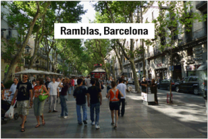
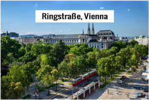
When you hear the word boulevard what picture comes to mind? In some cities where I have lived, the word is associated with a wider-than usual street that accommodates not only motor vehicles but includes bike lanes, walkways and communal green spaces as well. Some of Washington DC’s avenues, with their circles, squares and triangular parklets enhancing major intersections, exhibit the European-style streetscape of a boulevard. Cities like Vienna or Paris also come to mind as places where the term invokes a people-friendly street scene, and not a noisy dangerous highway. Here in Pittsburgh we have a handful of prominent city boulevards, all devoid of engaging public spaces but abundant in visibly crumbling and outdated urban infrastructure.
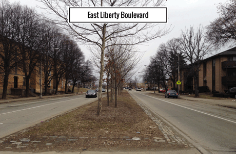
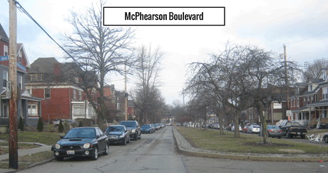
We do have some local boulevards that aren’t just highways—the East End of Pittsburgh boasts several pleasant boulevards, such as East Liberty Boulevard, Thomas and McPherson Boulevards in North Point Breeze, and Washington and Negley Run Boulevards in Larimer. Although a lack of proper signaling negatively impacts safety for pedestrians and bicycle riders, green medians, sidewalks and bike lanes contribute to a lovely sense of community along some stretches of these roads.
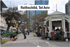
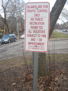
These are boulevards that have some of the infrastructure in place and can benefit from further programming and design adjustments that would elevate them to world-class, beautiful and vibrant multi-modal thoroughfares. Currently, even though East Liberty Boulevard has green medians, they are not designed for use as gathering places and only function to capture stormwater and visually enhance the roadway with shrubs and trees. Likewise, Thomas Boulevard actually has a sign posted that forbids people from walking or congregating in the medians! A European style boulevard draws people into the center, with benches, gathering spaces and sometimes commercial kiosks, public art and special events during warm weather months.
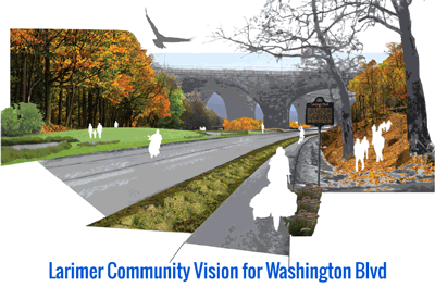
There are already some efforts along these roads to improve conditions. In the Larimer neighborhood, evolveEA is part of a project called Living Waters of Larimer that is engaging the community in the design of green stormwater infrastructure. Washington and Negley Run Boulevards—two roads built on top of streams that carried stormwater from the surrounding high ground through valleys and into the Allegheny River, border the neighborhood. Since the streams were paved over in the mid-twentieth century, dangerous flooding on Washington Boulevard has led to fatal accidents on several occasions.
Washington Boulevard has long been a death trap for people on bicycles and on foot because of the lack of sidewalks and a design that encourages speeding. It is also an unsustainable and dangerous space for motorists, and the subject of public complaints as far back as the 1950s. Part of the Living Waters project involves the design of a Little Negley Run alongside parts of the historic stream path, which will provide not only stormwater mitigation but recreational green space as well. Boulevards in Larimer present opportunities for the greater community to engage with neighbors around safer traffic conditions, cleaner waterways, and corridors that connect several neighborhoods to each other and to nearby parks.
Following Washington Boulevard to the west where it emerges from a steep valley and becomes Fifth Avenue, it is plausible to imagine a network of green boulevards. From there the road extends into Homewood and Point Breeze, and connects to McPhearson and Thomas Boulevards as well as Beechwood Boulevard, which borders the city’s largest park.
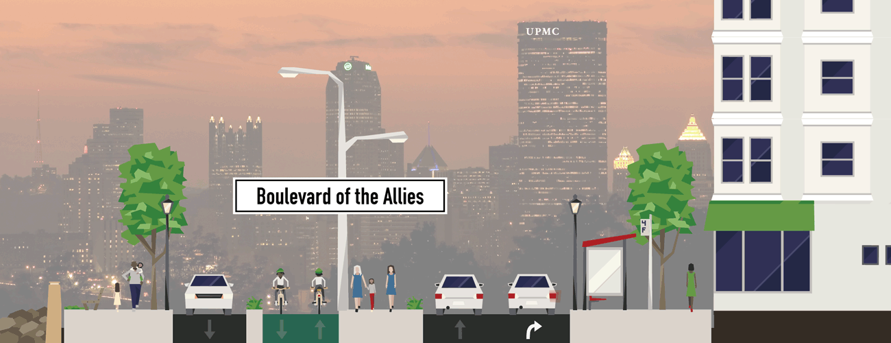
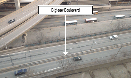
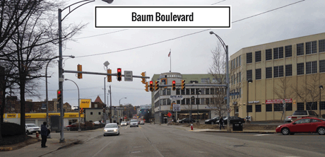
This year the City of Pittsburgh is launching a number of initiatives that can create opportunities to redefine the local meaning of the word Boulevard in ways that might align with long-term plans to create a “Green Boulevard” along the Allegheny Riverfront. The Allegheny Green Boulevard Plan was developed between 2011 and 2013, and communities along that edge of the city have been incrementally working towards bringing it to life. But when in a car, on a bike or on foot, traversing such arterial routes like Bigelow and Baum Boulevards or The Boulevard of the Allies through Downtown and along the Bluff into Oakland, leaves me asking the question:
Shouldn’t all Boulevards be Green Boulevards?
Among the City programs kicking-off this year are a Complete Streets initiative and a Vision Zero plan, both presenting prospects for the types of improvements that may actually answer my question in the affirmative. Complete Streets is a planning term and set of streetscape design best practices that accommodates multiple forms of transportation and helps keep traffic moving in lanes that are dedicated for motorists, people on bikes and on foot and sometimes buses or streetcars. During a bicycle tour held last year by BikePittsburgh in cooperation with the City, officials described plans to demonstrate Complete Streets implementation in its redesign and reconstruction of Smithfield Street, a prominent downtown corridor that cuts across the Golden Triangle and is flanked by shops, office towers and Mellon Square.
Similarly, Pittsburgh hosted last year’s Pro Walk Pro Bike Pro Place international conference and the City used the occasion to hype its adoption of a Vision Zero commitment. The Vision Zero initiative was first championed in Sweden and has been adopted by over a dozen municipalities around the world, including New York City and San Francisco. The concept can be summarized in one sentence: No loss of life is acceptable. Instead of placing responsibility for safety on road users, the Vision Zero Initiative puts this responsibility on system design, emphasizing market options and involving all of society in the effort to save lives. One of the first actions taken by the City of New York after its official Vision Zero commitment was to cap the speed limit on all city streets at 25 MPH.
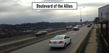
With Boulevard of the Allies, Baum Boulevard and Bigelow Boulevard offering some of Pittsburgh’s most direct routes through the city’s urban core, safety has fallen by the wayside while multi-lane, highway speed traffic has come to characterize these roads. Safety isn’t the only sacrifice—Allies and Bigelow follow topographic contours along the city’s hilltops that provide some of the most beautiful views in the region. Similarly, the Fort Pitt and Fort Duquesne Boulevards that connect bridges to Point State Park offer beautiful views of the three rivers. Can you imagine sidewalks and bikeways along these roads that would provide continuous mobility along a beautiful stretch that connects our East End neighborhoods to Uptown, the Hill District, Oakland and Downtown?
One thing people love about Pittsburgh and other cities are public amenities that allow us to experience the urban landscape collectively and individually. Green boulevards can provide smooth flow of car traffic that doesn’t put people who are outside of cars in danger, and amenities that foster healthy and active lifestyles and social interactions. While some historically neglected neighborhoods are experiencing their first significant reinvestment in decades with planning initiatives that will set ambitious development goals, let’s keep our eye on these boulevards that cut through the heart of the Greater Hill District and the East End.
Let’s make every Boulevard a Green Boulevard.